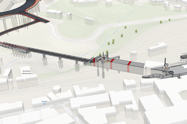
FCC Construcción and Convensa present the success story of GIS and BIM integration on the Rubi Line of the Porto Metro
FCC Construcción and Convensa present the success story of GIS and BIM integration on the Rubi Line of the Porto Metro

The FCC Construcción-Convensa-ACA consortium took on the challenge of executing the largest project in Portugal's Recovery and Resilience Plan: the construction of the new Rubi (H) Line of the Porto Metro, between Casa da Música and Santo Ovídio, with a budget of over £379 million.
The main challenges included:Comprehensively monitoring the progress of the work and managing resources in a complex, large-scale infrastructure
- Minimising the environmental impact, especially on trees and the urban environment.
- Coordinating multidisciplinary teams and sharing information in real time for agile and collaborative decision-making.
- Ensuring the traceability and accuracy of all data generated during the work.
To overcome these challenges, FCC Construcción and Convensa, in collaboration with Esri Spain, implemented an advanced integration of geospatial and digital modelling technologies, highlighting:
- Combined use of GIS (Geographic Information Systems) and BIM (Building Information Modelling) for the centralised and geolocated management of all construction models and spatial data for the project.
- Creation of digital twins using 3D models generated from LIDAR point clouds, 360º photography and auscultation sensor data, enabling real-time monitoring of the infrastructure and the environment.
- Automatic synchronisation of BIM models with real-time data through the ArcGIS platform and the Autodesk cloud, facilitating collaborative work and interoperability between teams.
- Implementation of a monitoring system with sensors (inclinometers, piezometers, optical systems) whose data is displayed on a single dashboard.
- Cataloguing and digital monitoring of the affected tree populations, with real-time access and updates for authorities and municipal services, thanks to specific mobile applications.
The application of this technological solution has provided tangible and strategic benefits:
- Operational efficiency: reduction in time and costs thanks to centralised information management and smooth collaboration between multidisciplinary teams.
- Better control and decision-making: real-time visualisation and analysis of work progress and environmental impact, enabling agile and informed responses.
- Sustainability and environmental commitment: efficient identification and protection of trees and the environment, optimising mitigation measures and facilitating the traceability of environmental actions.
- Innovation and industry benchmark: the project has become an international benchmark in infrastructure digitalisation, presented at the Esri International Infrastructure Management & GIS Conference.


